Welcome to the Btown Monitoring Post, the official blog site of the Teak Publishing Co. in western North Carolina. This where we post current news items, radio related bulletins, and reference material that will be of interest to a wide variety of radio monitors. Copyright © 2006-2021 by Teak Publishing, who is solely responsible for the content on this blog. All rights reserved and redistribution these pages in any format without prior permission is prohibited. Links to stories are permitted.
Pages
- Home
- Teak Publishing Amateur Radio Digital Voice Resource List
- The Spectrum Monitor Index 2014-2018
- Civilian Air Cargo/Airline and Select Military Call Signs
- Russian Aviation HF Long Distance Frequencies
- VHF ACARS / HFDL (aka 'HF ACARS) 12 March 2021 Update
- U.S. Coast Guard/Navy HF Fax Station Schedules - U...
- Civilian Aero/Military HF Frequency List - Update 9 January 2023
Sunday, July 30, 2006
Kompsat-2 Launched
Kompsat-2 (Arirang-2) developed by KARI (Korea Aerospace Research Institute) was launched 28 July 2006 at 0705 UTC from Plesetsk on Eurockot’s Rokot (SL-19) launch vehicle. Kompsat-2 SSC number is 29268/International designator 2006-031A. The satellite is in a sun-synchronous (98.1 deg inc) orbit.
The mission for this 760-kg satellite is to carry scientific instruments for observation of natural resources, digital map-making and atmospheric research, and high resolution imaging with a multi spectral camera (MSC) that can capture down to 1-meter black and white high-resolution imagery and 4-meters color.
The satellite transmits its data using a 320 Mbit/s QPSK encrypted X-band downlink at 8205.0 MHz. It is also using an unknown S-band downlink for TT&C.
Thursday, July 27, 2006
Dnepr Rocket Launch a Failure - 18 Satellites Lost
The Wednesday launch of an ISC Kosmotras Dnepr rocket ended in failure moments after liftoff from an underground missile silo in Kazakhstan. The first stage of the rocket, a decommission Russian SS-18 ICBM, apparently shutdown 86 seconds after liftoff (about 10 seconds early). The rocket and its payload of 18 satellites fell back to earth 16 miles south of the Baikonur Cosmodrome.
The Dnepr carried 18 satellites in all, including a remote sensing spacecraft for Belarus, a Russian student-built satellite, two Italian university microsatellites, and 14 palm-sized CubeSat payloads housed inside five portable deployment devices.
The payloads lost due to this failure included:
BelKA - the first orbiting satellite for Belarus. An Earth observation platform, built by Energia in Russia, to carry out a robust remote sensing campaign for Belarus and other users worldwide.
Baumanets - a Russian microsatellite built by a group of students at the Moscow State Technical University. The small spacecraft was to have operated in space for at least one year as an educational tool and technology pathfinder for students.
UniSat 4 - an Italian payload was the fourth member of a series of microsatellites managed by professors and students at the University of Rome.
PICPOT - another Italian payload that was designed and developed by engineering students in Torino, Italy.
Also lost were 14 CubeSats from 10 different universities and 1 private company. The launch was coordinated by California Polytechnic State University. The Cubesats lost included:
AeroCube-1 built by The Aerospace Corporation and carried a 902 to 928 MHz spread spectrum downlink.
CP-1* and CP-2* built by California Poly Tech. They carried 436.845 and 437.325 MHz downlinks respectively.
ICE Cube-1* and ICE Cube-2* developed by Cornell University and carrying 437.305 and 437.425 MHz downlinks respectively.
ION* built by the University of Illinois with a 437.505 MHz downlink.
HAUSAT-1* built by Hankuk Aviation University in South Korea with a 437.465 MHz downlink.
KUTESat* built by Kansas University with a 437.385 MHz downlink.
MEROPE* built by Montana State University with a 145.980 MHz downlink.
nCube-1* developed by several Norway universities carried a 437.305 MHz downlink.
RINCON* and SACRED* built by the University of Arizona. They each carried a 436.870 MHz downlink.
SEEDS* built by Nihon University in Japan and carrying a 437.485 MHz downlink.
Voyager* built by the University of Hawaii and carrying a 437.405 MHz downlink.
Satellites marked with an asterisk would have carried an amateur radio band downlink and would have picked up an OSCAR satellite number from AMSAT if it would have been operational.
More information on this satellite program and a preliminary timeline of this launch failure can be found on the Cubesat website.
The Dnepr carried 18 satellites in all, including a remote sensing spacecraft for Belarus, a Russian student-built satellite, two Italian university microsatellites, and 14 palm-sized CubeSat payloads housed inside five portable deployment devices.
The payloads lost due to this failure included:
Also lost were 14 CubeSats from 10 different universities and 1 private company. The launch was coordinated by California Polytechnic State University. The Cubesats lost included:
Satellites marked with an asterisk would have carried an amateur radio band downlink and would have picked up an OSCAR satellite number from AMSAT if it would have been operational.
More information on this satellite program and a preliminary timeline of this launch failure can be found on the Cubesat website.
Wednesday, July 19, 2006
Monitoring the Pro Voice Digital Protocol - Not!
I have noticed some people using Google searching for information on how to monitor a radio trunk system that uses the ProVoice digital protocal.
In short, "you won't, and there will not be a scanner that will include that mode." M/A-COM has made it clear that they will NOT allow the scanner manufacturers a license to include that proprietary codec in a scanner. The IMBE vocoder is used in ProVoice, but ProVoice is not compatible with Project 25, so a Project 25 scanner will not automatically be able to follow ProVoice systems.
Oh yes, same thing applies for:
Open Skies, which is used by the Pennsylvania statewide public safety system uses the popular Internet Protocol (IP) and is rather unique in that all radio traffic is digital from one end of the system to the other. OpenSky uses a different DVSI vocoder known as AMBE (Advanced Multi-Band Excitation), and is not compatible with Project 25.
Aegis was originally developed by Ericsson (now M/A-COM) that uses yet another type of vocoder, and it is not compatible with Project 25.
Motorola VSELP is an older Motorola ASTRO digital protocol that uses a different vocoder referred to as VSELP, which stands for Vector Sum Excited Linear Prediction. As with any non-IMBE vocoder, VSELP is not compatible with Project 25.
And those are the facts folks.
Tuesday, July 18, 2006
TS Beryl Forms off Carolina Coast
Tropical Storm Beryl has formed off the Carolina coastline. Latest information on this storm is available at http://www.nhc.noaa.gov/index.shtml?text. My hurricane information frequency list was last updated July 6 and is posted to this blog.
Monday, July 17, 2006
Lebanon Ham Net Active
Courtesy of the DX newsgroup and Hani OD5TE:
In support of the current situation in Lebanon, the Arab Amateur Radio Emergency Service has been activated on 14.305 MHz in order to take Welfare and Emergency messages. At the same time all local repeaters in Lebanon will have priority for emergency use.
OD5TE/R: 144.700- T88.5 (Covering Greater Beirut Are and Main Lebanese coastal road)
OD5RAK/R: 144.025+ T88.5 (Covering Northern Lebanon)
Repeaters will be linked through Echolink at all time to allow maximum coverage.
Friday, July 14, 2006
Satellite Launch 2006-026A
The Bigelow Aerospace Genesis 1 was launched from a new Russian launch site on 12 July 2006 at 1453 UTC. The payload was launched on a Dnepr rocket (a converted SS-18 ICBM) from their new Dombarovskiy launch site, previously just an intercontinental missile base (also identified as the ISC Kosmotras space and missile complex in the Orenburg region of Russia).
Bigelow Aerospace is located in North Las Vegas, Nevada. Genesis 1 is a prototype of hardware that the firm anticipates will advance habitable structures in space to carry out research and manufacturing, among other tasks.
Intl Desig: 2006-026A, SSC #29252
Orbital parameters:
Apogee 561 km
Perigee 555 km
Inclination 64.5 deg
The module inflated from 1.9 to 3.8 meters diameter once on orbit.
We believe that the Genesis 1 might be carried a 2 GHz S-band downlink.
Friday, July 07, 2006
Night of Nights VII
HISTORIC MORSE CODE RADIO STATION KPH RETURNS TO THE AIR FOR "NIGHT OF NIGHTS VII"
From the Maritime Radio Historical Society website. Photo and information courtesy of MRHS.
Former RCA Station KPH Celebrates Its 101st Anniversary
Coast Station KSM Celebrates Its 1st Anniversary
Coast Stations WLO, KLB, NMC and NOJ To Be On The Air
New Frequencies for KSM, KLB and NOJ
In the seventh annual event that has become known as the "Night of Nights", historic Morse code radio station KPH will return to the air in commemoration of the last commercial Morse message sent in the United States. Frequencies and reception report information for all stations appear below.
KPH, the ex-RCA coast station located north of San Francisco, will return to the air for commemorative broadcasts on 12 July at 1701 PDT (13 July at 0001 UTC), 7 years and one minute after the last commercial Morse transmission in the US. These on-the-air events are intended to honor the men and women who followed the radiotelegraph trade on ships and at coast stations around the world and made it one of honor and skill. Transmissions are expected to continue until at least midnight PDT (0700 UTC).
Veteran Morse operators, including former KPH staff members, will be on duty at the receiving station at Point Reyes, CA listening for calls from ships and sending messages just as they did for so many years before Morse operations were shut down.
The transmitters are located 18 miles south of Point Reyes in Bolinas, CA at the transmitting station established in 1913 by the American Marconi Co. The original KPH transmitters, receivers and antennas will be used to activate frequencies in all the commercial maritime HF bands and on MF as well.
Many of the KPH transmitters will be 50s vintage RCA sets. KSM will use a 1940s vintage Press Wireless PW-15 transmitter will be on its 12 MHz frequency. Power output will be 4 to 5kW. The transmitting antennas include a Marconi T for MF, double extended Zepps for 4, 6 and 8 MHz and H over 2s for 12, 16 and 22 MHz.
KPH will send traffic lists, weather and press broadcasts as well as special commemorative messages, some of which will be sent by hand. At other times the KPH and KSM "wheel" will be sent to mark the transmitting frequencies.
Members of the public are invited to visit the receiving station for this event. The station will be open to visitors beginning at 1500PDT (3:00pm). The station is located at 17400 Sir Francis Drake Boulevard and is on the route to the Point Reyes lighthouse. Watch for a cypress lined driveway on the right about a mile past the entry to Coast Guard station NMC.
KPH is operated by the Maritime Radio Historical Society in cooperation with the Point Reyes National Seashore, part of the National Park Service.
Further information may be found on the Maritime Radio Historical Society Web site or by contacting Richard Dillman at +1 415-990-7090 (email: rd@radiomarine.org or Tom Horsfall at +1 510-237-9535 (email: wa6ope@hotmail.com. Station Information follows...
KPH
KPH will transmit on 4247.0, 6477.5, 8642.0, 12808.5, 17016.8 and 22477.5 kHz on HF and 500 and 426 kHz on MF. These frequencies have been made available through the generous cooperation of Globe Wireless, the current owner of the KPH and KFS licenses. KPH operators will listen for calls from ships on ITU Channel 3 in all bands. The Channel 3 frequencies are 4184.0, 6276.0, 8368.0, 12552.0, 16736.0 and 22280.5 kHz on HF and 500 kHz on MF. Reception reports may be sent to: Ms. DA Stoops, P.O. Box 381, Bolinas CA 94924-0381 USA. Denice is a former KPH operator and was the first female telegrapher hired at the station.
KSM
Note the addition of a 16 MHz channel for KSM this year. KSM will transmit on 426, 500, 6474, 12993 and 16914 kHz. KSM will listen for calls from ships on 500 kHz and HF Channel 3 (see KPH listing for frequencies). Reception reports may be sent to: Ms. DA Stoops, P.O. Box 381, Bolinas CA 94924-0381 USA
WLO
This information has not been confirmed by WLO at the time of this announcement. WLO will transmit on 438, 500, 8514.0 and 12660.0 kHz. WLO will listen for calls from ships on 500 kHz and HF Channel 3 (see KPH listing for frequencies). Reception reports may be sent to: WLO/KLB, 700 RINLA AVENUE, MOBILE, ALABAMA 36619 USA or via email to: wloradio@wloradio.com.
KLB
Note the expanded frequencies for KLB! This year KLB has added MF, a 2 MHz frequency and a 12 MHz frequency. A tip of the MRHS earphones to CJ of KLB for all the work he has done to bring this about. KLB will transmit on 488, 500, 2063.0, 6411.0 and 12917.0 kHz. KLB will listen for calls from ships on 500 kHz and HF Channel 3 (see KPH listing for frequencies). Reception reports may be sent to: WLO/KLB, 700 RINLA AVENUE, MOBILE, ALABAMA 36619 USA or via email to: wloradio@wloradio.com
NMC
NMC will transmit on 448, 472, 500, 6383.0, 8574.0 and 17220.5 kHz. NMC will listen for calls from ships on 500 kHz and HF Channel 3 (see KPH listing for frequencies). Reception reports may be sent to: COMMANDING OFFICER, ATTN ITC ERIC SIMMONS, COMMUNICATIONS AREA MASTER STATION PACIFIC, 17000 SIR FRANCIS DRAKE BLVD, POINT REYES STATION, CALIFORNIA 94956-0560 USA
NOJ
Note that NOJ will be operational on MF this year! NOJ will transmit on 416, 470, 500, 8650.0, 12889.5 and 16909.7 kHz. NOJ will listen for calls from ships on Channel 3 (see KPH listing for frequencies). Reception reports may be sent to: COMMANDING OFFICER, ATTN OSCM WILLIAM KECKLER, US COAST GUARD COMMUNICATIONS STATION KODIAK, PO BOX 190017, KODIAK, ALASKA 99619 USA
BT
BV ES VY 73 TO ALL,
MRHS
Wednesday, July 05, 2006
A Special Offer for MT Blog Readers
The good folks at Monitoring Times magazine are offering a special, limited time, discounted rate of US$14.95 on a one year MT Express subscription if you mention the BLOG page (Editor’s Page, Fed Files, Milcom, Monitoring Post, or Shortwave) you are viewing right now.
What is Monitoring Times magazine?
MT is a full-spectrum monthly magazine for the radio listener, Monitoring Times covers scanning, shortwave, military and federal comms, and other radio topics from below 500 kHz to 900 MHz and above. Presented in an easy-to-understand style by an experienced writing staff, MT helps you get the most out of your time and your equipment with practical listening tips and frequencies.
What is MT Express?
MT Express is the same magazine as our printed version but it is presented in Adobe Acrobat portable document file (pdf) format, including full color photography and active links to URLs and email addresses. It is the fastest and easiest way to get the information and frequencies you need on the radio hobby.
You can see what is in current issue of MT, including sample pages on the MT current issue webpage.
This special offer is for first-time subscribers and renewals. This offer is available for a limited time only (must be used by the close of business July 31, 2006) and can only be used one time per customer.
So if you like what we do here on the MT Blog pages and you want even more, then pick up that telephone and call the MT order desk toll free at 1-800-438-8155 (Mon-Fri 9a-5p EDT) and get US$5.00 off the regular price of MT Express.
And remember you have to mention the BLOG page you are viewing right now in order to get the MT Express Bloggers discount.
STS-121 (2006-028A) 06185.80348940 TLE
The launch of the STS-121 mission occurred from the Kennedy Space Center at 1837:55 UTC. The NORAD SSC number is 29251 and the international designator is 2006-028A.
Here is the latest two line element set for STS-121.
STS-121
1 29251U 06028A 06185.80348940 .00055600 12106-4 74006-5 0 17
2 29251 51.6297 97.2629 0057780 342.0046 193.3540 16.29698905 02
Tuesday, July 04, 2006
NASA Space Shuttle Launch TLEs - Again
Here are the posted elements for the launch attempt this afternoon July 4.
SHUTTLE TRAJECTORY DATA
Lift off time (UTC) : 2006/185/18:37:55.000
Area (sq ft) : 2700.0
Drag Coefficient (Cd) : 2.00
Monthly MSFC 50% solar flux (F10.7-jansky) : 79.4
Monthly MSFC 50% earth geomagnetic index (Kp) : 2.22
ET - UTC (sec) : 65.18
UT1 - UTC (sec) : 0.00
Coasting Arc #1 (begining on orbit 1)
Vector Time (GMT): 2006/185/18:48:24.000
Vector Time (MET): 000/00:10:29.000
Weight (LBS) : 255113.7
TWO LINE MEAN ELEMENT SET
SHUTTLE
1 99999U 06185.83405673 .00014500 00000-0 95600-4 0 9007
2 99999 51.6298 97.0761 0039171 347.5451 12.4801 16.76636654 26
Coasting Arc #2 (begining on orbit 1)
Vector Time (GMT): 2006/185/19:16:26.918
Vector Time (MET): 000/00:38:31.918
Weight (LBS) : 252602.1
TWO LINE MEAN ELEMENT SET
SHUTTLE
1 99999U 06185.83481559 .00014500 00000-0 95600-4 0 9015
2 99999 51.6298 97.0838 0054912 341.1886 18.7277 16.30517194 26
Coasting Arc #3 (begining on orbit 11)
Vector Time (GMT): 2006/186/10:43:39.699
Vector Time (MET): 000/16:05:44.699
Weight (LBS) : 251561.4
TWO LINE MEAN ELEMENT SET
SHUTTLE
1 99999U 06186.44742686 .00014500 00000-0 95600-4 0 9025
2 99999 51.6324 93.6688 0083791 348.1321 11.7892 16.23859786 124
You can get the complete set at Shuttle Trajectory Data
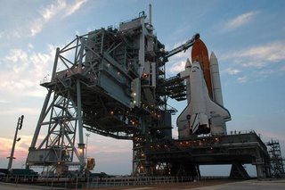
Image courtesy of NASA/KSC.
Space Shuttle Replacement Announced
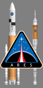
Even as NASA tries to get STS-121 off the launch pad at KSC, NASA has announced the new system that will replace the Shuttle Transportation System (STS), named Ares. The Crew Launch Vehicle, being developed on the basis of the Shuttle SRB to launch the next NASA human-carrying spaceship, will be called the Ares I. The planned heavy-lift follow on will be called the Ares V.
It's appropriate that we named these vehicles Ares, which is a pseudonym for Mars," said Scott Horowitz, associate administrator for NASA's Exploration Systems Mission Directorate, Washington. "We honor the past with the number designations and salute the future with a name that resonates with NASA's exploration mission."
The "I and V" designations pay homage to the Apollo program's Saturn I and Saturn V rockets, the first large U.S. space vehicles conceived and developed specifically for human spaceflight.
The crew exploration vehicle, which will succeed the space shuttle as NASA's spacecraft for human space exploration, will be named later. This vehicle will be carried into space by Ares I, which uses a single five-segment solid rocket booster, a derivative of the space shuttle's solid rocket booster, for the first stage. A liquid oxygen/liquid hydrogen J-2X engine derived from the J-2 engine used on Apollo's second stage will power the crew exploration vehicle's second stage. The Ares I can lift more than 55,000 pounds to low Earth orbit.
Ares V, a heavy lift launch vehicle, will use five RS-68 liquid oxygen/liquid hydrogen engines mounted below a larger version of the space shuttle's external tank, and two five-segment solid propellant rocket boosters for the first stage. The upper stage will use the same J-2X engine as the Ares I. The Ares V can lift more than 286,000 pounds to low Earth orbit and stands approximately 360 feet tall. This versatile system will be used to carry cargo and the components into orbit needed to go to the moon and later to Mars.
Picture courtesy of NASA.
Sunday, July 02, 2006
STS-121 NASA Estimated Orbital Elments
From Ted Molczan and the world famous Seesat-L newsgroup:
Lift-off is scheduled for 2006 Jul 02 at 19:26:06 UTC. Spaceflight Now reports that the weather forecast is for only a 30 percent probability of GO for launch:
http://www.spaceflightnow.com/shuttle/sts121/status.html NASA's estimated elements are available at the following URL. They take into account all planned manoeuvres, and are revised throughout the mission, as required.
http://spaceflight1.nasa.gov/realdata/sightings/SSapplications/Post/JavaSSOP/orb
it/SHUTTLE/SVPOST.html
For quick reference, I have extracted the elsets from MECO through docking.
1. Jul 02, 19:36:34 UTC (MECO) - Jul 02, 20:04:45 UTC
1 99999U 06183.81706019 .01000000 00000-0 37638-6 0 02
2 99999 51.6315 107.4812 0133623 347.8400 69.9204 16.48996984 09
NOTE: NASA's MECO 2-line elset is erroneous; so I generated the above by
converting NASA's True of Day Rotating (TDR) [aka Earth-Fixed Greenwich (EFG)] Cartesian state vector to SGP4, using Ken Ernandes' VEC2TLE program, and added realistic decay terms for the brief duration of existence of the orbit. Our web site has a link to Ken's program:
http://www.satobs.org/orbsoft.html#Other
2. Jul 02, 20:04:45 UTC - Jul 03, 11:25:57 UTC
1 99999U 06183.86828433 .00014500 00000-0 95600-4 0 9012
2 99999 51.6315 107.1944 0055919 341.8910 18.0289 16.30320029 25
3. Jul 03, 11:25:57 UTC - Jul 03, 16:01:09 UTC
1 99999U 06184.48096052 .00014500 00000-0 95600-4 0 9026
2 99999 51.6338 103.7803 0075880 339.8798 19.9405 16.25901597 126
4. Jul 03, 16:01:09 UTC - Jul 03, 21:02:19 UTC
1 99999U 06184.72675604 .00014500 00000-0 95600-4 0 9030
2 99999 51.6304 102.4155 0074319 340.6093 19.2273 16.26481625 165
5. Jul 03, 21:02:19 UTC - Jul 04, 11:20:37 UTC
1 99999U 06184.91191402 .00014500 00000-0 95600-4 0 9041
2 99999 51.6279 101.3924 0067724 147.0385 213.5038 15.93209272 193
6. Jul 04, 11:20:37 UTC - Jul 04, 12:51:50 UTC
1 99999U 06185.47638584 .00014500 00000-0 95600-4 0 9051
2 99999 51.6296 98.4155 0010064 87.8137 272.4181 15.78424640 289
7. Jul 04, 12:51:50 UTC - Jul 04, 14:11:14 UTC
1 99999U 06185.53969537 .00014500 00000-0 95600-4 0 9064
2 99999 51.6310 98.0883 0010018 46.9068 313.2933 15.76762016 298
8. Jul 04, 14:11:14 UTC - Jul 04, 14:25:06 UTC
1 99999U 06185.60307278 .00014500 00000-0 95600-4 0 9071
2 99999 51.6314 97.7612 0009245 38.9159 321.2669 15.76455737 306
9. Jul 04, 14:25:06 UTC - Jul 04, 15:40:00 UTC
1 99999U 06185.60307255 .00014500 00000-0 95600-4 0 9087
2 99999 51.6317 97.7611 0010246 36.0397 324.1457 15.76223425 308
10. Jul 04, 15:40:00 UTC (docked to ISS)
1 99999U 06185.66721116 .00014500 00000-0 95600-4 0 9090
2 99999 51.6300 97.4474 0010473 36.1450 324.0420 15.76118558 317
Ted Molczan
Saturday, July 01, 2006
North Atlantic HF Aero Frequencies
From time to time I enjoy monitoring the HF MWARA frequencies. And the most active in this part of the world are the NAT family of frequencies. Here is an updated list for those we need it.
North Atlantic Major World Aero Route HF Frequencies
MWARA (Major World Air Routes) North Atlantic (NAT) family of frequencies. Here you will find airline, charter, military and biz aircraft (mode is USB):
NAT-A North Atlantic Family A: 3016.0 5598.0 8906.0 13306.0 17946.0
Canarias, Gander, New York, Paramaribo, Piarco, Santa Maria, Shanwick
NAT-B North Atlantic Family B: 2899.0 5616.0 8864.0 13291.0 17946.0
Gander, Iceland, New York, Santa Maria, Shanwick
NAT-C North Atlantic Family C: 2872.0 5649.0 8879.0 11336.0 13306.0 17946.0
Gander, Iceland, Shanwick
NAT-D North Atlantic Family D: 2971.0 4675.0 8891.0 11279.0 13291.0 17946.0
Arctic Radio (Baffin), Bodo, Churchill (Emerg's Only), Gander, Iceland,Shanwick
NAT-E North Atlantic Family E: 2962.0 6628.0 8825.0 11309.0 13354.0 17946.0
New York, Santa Maria
NAT-F North Atlantic Family F: 3476.0 6622.0 8831.0 13291.0 17946.0
Gander, Shanwick
The best online guide I have seen on this that will answer many questions is at: www.liveatc.net/downloads/NAT-HF-Guidance.pdf. You should download this and study it to understand completely the NAT MWARA system.
Shuttle INMARSAT/Milsat Net Update 7/1/2006 @ 1325
Barney Hamlin checks back in and has the following update on INMARSAT frequencies being used in support of the STS-121 launch.
NASA KSC was heard on five Inmarsat frequencies yesterday:
1535.5250
1538.4500
1539.5250
1539.8750
1540.0500
1539.8750 was the most active. A few times during the day traffic could be heard simultaneously on two channels. They had a big pre-flight briefing at 10a.m. yesterday which lasted over an hour. Traffic was monitored throughout the day until approximately 3 p.m. Eastern Time yesterday afternoon (June 30).
As Paul Marsh mentioned, 261.875 on UHF milsat was very active during this same period with several aircraft contacting Cape Osborne (Cape Radio) and Wolf Hound.
Call signs included: Mexican (a/c) Rescue Bird (a/c),and East Rescue Bird (a/c).
So far nothing has been heard today.
And I concur with Barney and Paul's observations. Today has been quiet accept for an occasional HF check on ETR Primary (10780 kHz USB).
10780 kHz USB is Up
Cape Radio is calling Ascension Radio on 10780 kHz (USB) ETR Primary (HF-GCS backup) at 1255 UTC.
Subscribe to:
Posts (Atom)