Thursday, August 31, 2006

Is Solar Cycle 24 Beginning?


From the ARRL website:

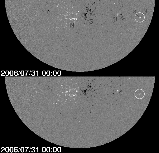
The recent appearance on the sun of two so-called "backward sunspots" may mean solar Cycle 23 is drawing to a close and Cycle 24 now is under way or soon will be. At least that's the thinking of some scientists. "We've been waiting for this," said Solar Physicist David Hathaway of the Marshall Space Flight Center in Huntsville, Alabama, after the first backward spot showed up. "

A backward sunspot is a sign that the next solar cycle is beginning." The term "backward" refers to the sunspots' magnetic polarity. One such sunspot appeared briefly July 31, then disappeared, but its significance was that its magnetic polarity was just the opposite of current Cycle 23 spots.

Another more robust spot, Sunspot 905, appeared earlier this month -- although it subsequently began to dissipate -- and some sungazers are saying Cycle 24 already has begun.

ARRL propagation guru Tad Cook, K7RA, has been a bit more cautious. "As time goes on, there will be more Cycle 24 spots and fewer Cycle 23 spots," he said in a recent "Solar Update." In any event, radio conditions will not improve any time soon but over a period of several years of the course of the 11-year cycle, perhaps peaking around 2010.

You can find more on this backward sunspot on the NASA Science website.

Computing Unplugged weighs in on BPL

During this summer Computing Unplugged magazine, an online e-zine, has been covering the BPL vs Ham debate. While the editor of the magazine promised a fair and balanced discussion of this issue, it is quite obvious he is NOT a fan of ham radio or radio listening in general. It is quite obvious he is not qualified at any level to be writing about the downside of BPL and its impact on the radio spectrum. Unfortunately, his written words remain online. Truly journalism at its lowest level.

This debate was started by an interview that David Gewirtz, who is the Editor-in-Chief of the ZATZ magazines and the author of The Flexible Enterprise and Lotus Notes Revealed, contacted with a BPL industry insider! You can be reached him via email at david@zatz.com. Here are some of the lowlights from this individual who claims to be fair and balanced and a journalist.

"Who's funding the ARRL? Do the cable providers and DSL providers have an interest in this debate? After all, BPL is a direct competitor to cable modems and DSL services. Or is this truly the case of one technology interfering with another?

"Frankly, if it were just ham radio operators unable to play with their toys, this debate would be a non-issue. Ham radio is really a technology of the 20th Century. It was exciting back then when you couldn't call any country easily except with a ham radio. It was exciting when you couldn't talk to anyone when they were out and about unless they had an operator's license.

"But today, we have cell phones and Skype. We can talk to anyone, anywhere. And we can reach people all over the world merely for the cost of sustaining a broadband connection. Technology that can deliver broadband is, in Computing Unplugged's opinion, more valuable than ham radio as a hobby."

The thing that bothers me is he is assuming that the only service to get QRM from BPL is hams per se, since they are the major player fighting it. Although he mentioned a few others opposition comments in the FCC R&O, nothing was mentioned about our radio listening hobby. As most of you know BPL is not just a ham issue, but it is detrimental to the entire spectrum from the VHF lo band down into HF.

As part of this debate Fred Stevens, K2FRD/VO2FS posted this to the Ham DX Chat newsgroup:

My article in Computing Unplugged magazine on Broadband Over Powerline vs. ham radio (and everyone else who uses the HF and lower VHF airwaves) was published today. I wish I had more than the three days I was given (I normally prefer three months) to polish it, research and document more of my statements, maybe tone down some of the rhetoric a little, and add some qualifications to make it more technically accurate and, hence less subject to criticism. Not my best effort, but it'll do. Nevertheless, I'm honored that my letter was chosen for amplification and publication from the hundreds submitted. The article: http://www.computingunplugged.com/issues/issue200608/00001832001.html .

For those who aren't aware of it, Computing Unplugged dedicated its entire summer series to the BPL controversy and, after "fair and balanced" reporting, arrived at the conclusion that BPL in its present form needs to be scrutinized very closely before extensive future deployment and CU ultimately gave ham radio a generally positive and supportive review in the BPL battle.

Complete index of all twelve CU BPL articles including one from Allen Pitts W1AGP, ARRL Media and Public Relations Manager, also published today: http://www.computingunplugged.com/issues/issue200608/00001837005.html .

Computing Unplugged homepage which does NOT index all the BPL articles: http://www.computingunplugged.com/

For those seriously concerned about the future of ham radio as potentially affected by BPL, I encourage you to read the entire series of articles. If you are a radio listener of the HF or VHF low band spectrum, then this is a must read at Computing Unplugged magazine.

Tuesday, August 22, 2006

Monitoring Hotlanta


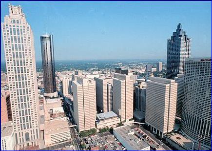
Last week Gayle and I ventured down to Atlanta GA and did a bit of monitoring. The mil stuff is on our milblog, but here is a summary of truck systems and conventional frequencies we snagged during our day trip.


Atlanta Public Safety and City Services
Motorola Type II Smartnet
856.4625 856.4875 857.4625 857.4875 858.2375 858.4375 858.4625 858.4875 858.7625 858.9375 859.2375 859.4375 859.4625 859.4875 860.2375 860.4625 860.4875 860.7625 860.9375 866.0625 866.3125 866.6125 866.7875 866.8625 867.1375 867.1875 867.3125

Forsyth County Public Safety
APCO P25 Exclusive
866.1000c 866.6500 867.6625 867.8625 868.2750 868.6000 868.9875

Fulton County Public Safety and County Services
Motorola Type IIi Hybrid
853.0375 854.5125 854.5625 855.6625 855.7375 856.3875 856.4125 857.3875 857.4125 858.3875 858.4125 859.3875

Georgia Emergency Wireless Interoperable Network (GEWIN)
APCO P25 Exclusive
Cobb County 856.2125 857.2125 858.2125 859.2125 860.9875 866.8875 867.5500 868.0375 868.3000
State Metro Atlanta TRS
866.4500 866.7500 867.2375 867.2875 867.4375 867.4875 868.0375 868.0875 868.3250 868.7000 868.7875

Conventional Frequencies
154.025 Calhoun PD repeater output (141.3 Hz PL)
155.625 Fannin/Gilmer County SO/PD Interagencysimplex
156.1275 Blue Ridge PD Dispatch repeater output (DCS 412)
156.240 Woodstock PD Dispatch repeater outpout (141.3 Hz PL)
158.730 Fannin County SO Dispatch repeater output (141.3 Hz PL)
158.730 Cherokee County SO Dispatch repeater output (156.7 Hz PL)
158.850 Gilmer County SO Dispatch repeater output (74.4 Hz PL)
159.540 Gordon County/Calhoun PD repeater output (141.3 Hz PL)

Friday, August 11, 2006

8/11/2006 Russian Launch Schedule/Manifest

Russian launch schedule courtesy of Andrey Krasil'nikov and NASA Spaceflight.com. Subject to change.

Date Satellite(s) Rocket/Upper stage Cosmodrome
2006
9/14 Soyuz TMA-9 Soyuz-FG Baikonur
10/7 MetOp-A Soyuz-2.1a/Fregat Baikonur
10/18 Progress M-58 Soyuz-U Baikonur
Oct/Nov Genesis 2 Dnepr Dombarovsky
11/10 Arabsat 4B/Badr 4 Proton Baikonur
12/5 SAR-Lupe 1 Kosmos-3M Plesetsk
12/15 Sumbandila Shtil' Sub in Barents sea
12/20 Progress M-59 Soyuz-U Baikonur
Dec Measat 3 Proton Baikonur
Dec Kosmos-242X (3 Glonass-M) Proton-K/DM-2 Baikonur
(TBD) Kosmos-242X (Don) Soyuz-U Baikonur
(TBD) Kosmos-242X (Meridian) Soyuz-2.1a/Fregat Plesetsk
(TBD) Kosmos-242X (Tselina-2) Zenit-2 Baikonur
(TBD) EgyptSat-1+more Dnepr Baikonur
(TBD) GIOVE-B Soyuz-FG/Fregat Baikonur
(TBD) TerraSAR-X Dnepr Baikonur

2007
Jan Genesis 2 Dnepr Dombarovsky
2/7 Progress M-60 Soyuz-U Baikonur
3/9 Soyuz TMA-10 Soyuz-FG Baikonur
7/28 Progress M-61 Soyuz-U Baikonur
9/2 Soyuz TMA-11 Soyuz-FG Baikonur
Sep SMOS, PROBA-2 Rokot/Briz-KM Plesetsk
(TBD) Meteor-M Soyuz-2.1b/Fregat Baikonur
(TBD) Corot Soyuz-2.1b/Fregat Baikonur
(TBD) Anik F3 Proton-M Baikonur

Wednesday, August 09, 2006

HFLINK NEWS #1

In this HFLINK NEWS Special Bulletin:
(1) ALE On-The-Air Week "AOTAW 2006" (13-23 October 2006)
(2) New Amateur Radio ALE Channel List 2006-2007
(3) Amateur ALE Standards
(4) Amateur ALE Net Calls
(5) New PCALE Version Now In Beta Testing Phase

Website: http://hflink.com

Dear ALE operator,
Welcome to the first edition of HFLINK NEWS! HFLINK NEWS is a Special Bulletin service of HFLINK Group. The HFLINK Special Bulletin is issued only a few times per year, to keep members of HFLINK Group informed about events and changes in ALE and Selcall worldwide. We hope to link with you soon, and please consider activating your station during ALE On The Air Week in October!

Best Regards,
Bonnie Crystal, KQ6XA
HFLINK Founder

=======BEGIN HFLINK NEWS SPECIAL BULLETIN======

=================================
ALE On-The-Air Week "AOTAW 2006"
=================================

Starts: 0001 UTC Friday 13 OCTOBER (13/10/06)
Ends: 1159 UTC Monday 23 OCTOBER (23/10/06)
10 Days of worldwide Amateur Radio ALE activity...

HFLINK is sponsoring a new International Amateur Radio event called: ALE On The Air Week (AOTAW). All ham radio operators worldwide are invited to participate in 10 days of amateur radio HF-ALE Automatic Link Establishment and HF Selcall activity. AOTAW is an open operating event to explore ALE communications and equipment. The experience gained by participation is also useful for HF emergency and disaster
relief communications.

There are now many hundreds of amateur radio operators worldwide with ALE stations. The AOTAW gives operators a chance to exercise ALE transceivers, antennas, software, systems, and operating procedures.

ALE Operator Certificate for AOTAW2006
=======================================

HFLINK issues a unique ALE Operator Certificate to operators who participate in AOTAW. To qualify for an ALE Operator Certificate, the operator must initiate and complete at least 5 QSOs through Automatic Link Establishment with other ALE operators. The ALE link must then be followed by a communication either by voice or texting. Additional certificate endorsement is issued by HFLINK for operators who link and QSO with 25 ALE stations or more. Logs: After the event, a very simple list of date/ callsign/ frequency log of QSOs should be sent in email plain text to: aotaw2006@ yahoo.com.

Operating Standards for AOTAW
==============================
AOTAW is not a contest. All operators are reminded to be courteous and operate within the recognised Amateur Radio ALE channels and standards. The ALE netcall "HFL" may be used as the general CQ call for the event. ALLCALLs (one-way linking) should not be used in AOTAW, and a QSO started by an ALLCALL does not qualify as a valid ALE link for certificate.

About AOTAW
============
AOTAW provides a way for more operators to gain valuable practical knowledge and expertise in the operation of an Amateur Radio ALE station. Amateur operators who use ALE for government and non-governmental organisations may be especially interested in participation, for this is a chance to explore the various operational
aspects of ALE that may not be utilised otherwise. The 10 days of AOTAW enables operators to participate as they can, for any amount of time in the event, and to experience ALE operation under various ionospheric propagation conditions. Also, an ALE demonstration Special Event HF Station will be in operation during the ARRL Pacificon convention in California USA on 14-15 October.

=============================================
New Amateur Radio ALE Channel List 2006-2007
=============================================
The new channel list is effective 01 September 2006. PCALE channel fill files (QRG) will be available in August.

ALE Automatic Link Establishment and Selective Calling
International Amateur Radio Service

Amateur Radio ALE Channel List 2006A
CHAN/ kHz /GENERAL-PURPOSE/IARU-REGION/(Sounding)
=================================================
01= 1806.0 VOICE-DATA- Regional R1,3
02= 1840.5 VOICE-DATA- Regional (Sound=R1)
03= 1845.0 VOICE DATA- INTERNATIONAL COMMON R1,2,3
04= 1996.0 VOICE-DATA- Regional (Sound=R2)
05= 3565.0 DATA-VOICE- Regional R1,3
06= 3617.0 DATA-VOICE- Regional (Sound=R1)
07= 3626.0 DATA-VOICE- Regional (Sound=R2)
08= 3791.0 VOICE- INTERNATIONAL COMMON R1,2,3
09= 3996.0 VOICE- Regional R2
10= 5371.5 VOICE- Emergency; Regional R1,2
11= 5403.5 VOICE-DATA- Emergency; Regional R1,2
12= 7030.5 DATA- Regional (Sound=R3)
13= 7040.5 DATA- Regional (Sound=R1)
14= 7065.0 VOICE- International/Regional R1,3
15= 7102.0 DATA-VOICE- International R1,2,3 (Sounnd=R2)
16= 7165.5 VOICE- INTERNATIONAL COMMON R1,2,3
17= 7296.0 VOICE- Regional R2
18= 10136.5 DATA- VOICE-International R1,2,3
19= 10145.5 DATA- INTERNATIONAL COMMON (Sound=R1,2,3)
20= 14100.5 DATA- International R1,2,3
21= 14109.5 DATA- International (Sound=R1,2,3)
22= 14342.5 VOICE-INTERNATIONAL COMMON; R1,2,3
23= 14346.0 VOICE-International R1,2,3
24= 18106.0 DATA- International (Sound=R2,3)
25= 18117.5 VOICE-DATA-INTERNATIONAL COMMON R1,2,3(Sounnd=R1)
26= 18157.5 VOICE-International R1,2,3
27= 21117.5 DATA- International(Sound=R1,3)
28= 21157.5 DATA- International R(Sound=R2)
29= 21437.5 VOICE- INTERNATIONAL COMMON R1,2,3
30= 24926.0 DATA- International (Sound=R1,2,3)
31= 24977.5 VOICE- International Regional R1,2,3
32= 28117.5 DATA- International/Regional (Sound=R1)
33= 28146.0 DATA- International/Regional (Sound=R2)
34= 28327.5 VOICE- INTERNATIONAL COMMON R1,2,3
35= 50162.5 VOICE-DATA- Regional
36= 144162.5 VOICE-DATA- Regional

Note 1) All Amateur Radio ALE channels use "USB" Upper SideBand (including frequencies below 10MHz). USB conforms to international standards for ALE / Selcall, and enables compatibility with commercial transceivers.

Note 2) The ALE-Selcall list is designed for international, regional, and local use in the Amateur Radio Service. All channels are subject to the different rules, regulations, and bandplans of the region and local country of operation. It is the responsibility of every operator to maintain the highest technical and ethical standards for all transmissions. Some channels or modes in the list may not be available in every country. The HF spectrum is a shared resource, so there is no
guarantee that a channel is clear in a local area or region.

Note 3) Use of 5MHz channels and frequencies may vary in each country. Although 5MHz ALE and SELCALL transmissions are authorised in some countries, USA does not yet allow it on 5MHz. Therefore, operators in USA may receive monitor the 5MHz channels, but care should be taken to lock out the transmitter from making ALE or Selcall transmissions (except in case of an Emergency).

======================
Amateur ALE standards
======================
1. ALE System= MIL-STD 188-141 ; FED-1045 (8FSK, 2kHzBW)
2. Call or sounding transmission duration: 30 seconds.
3. Scan rate: 1 or 2 channels per second.
4. Sounding Interval= 60 Minutes (or more) (for same channel)
5. CQ Call= Netcall to "HFL" net
6. Digi Texting/Data Audio Centre Frequency= 1500HZ (to 1800HZ)
7. Short text messaging standard = AMD
8. TWS SOUNDING (Recommended)
9. Always transmit "CLEAR LINK" after ALL CALLS and LINKING!

=======================
Amateur ALE Net Calls
=======================
1. HFL = CQ, ALL AMATEUR RADIO ALE STATIONS
2. HAM = EMERGENCY/RELIEF NET ONLY, AMATEUR:NGO/GOV
3. GPR = GEO POSITION REPORTS
4. RPT = STATION STATUS REPORTS
5. QRZ = REPLY CALL PROMPT
6. CQA = RESERVED FOR FUTURE USE

============================================
New PCALE Version Now In Beta Testing Phase
============================================
PCALE software author Charles Brain G4GUO has been working on the new version over the past year. Charles has been collaborating with Steve N2CKH (MARS-ALE) on the software and radio support, and with Bonnie KQ6XA on some of the innovative new features. A small group has been working behind the scenes using the experimental software. The exciting release of the new improved PCALE is dependent upon the successful testing of the PCALE Beta Version. A group of volunteer ALE amateur radio operators is now using it on the air. The PCALE Beta Test Group is looking for more operators, but membership is limited. If you are an experienced operator with PCALE or MARS-ALE, please consider it. Beta Test Group: http://groups.yahoo.com/group/pcale/

Some Of The New PCALE Features Now In Beta Testing:
====================================================
1. Separately programmable sounding and scanning channels
2. Sounding/traffic associated channels (similar to 3G ALE)
3. New Text Keyboarding window for real time texting
4. GPS interface with ALE-GPR (Geo-Position Reporting)
5. Automatic station status reporting (80 Character text)
6. Ambush (auto message, link when a specific station is heard)
7. Easy channel scan groups and alphanumeric group labeling
8. Improved spectrum scope display, sync, and audio AGC
9. Improved user interface and option setup
10. Improved scanning reliability and timing
11. Improved and expanded radio interface
12. CAT support for more transceivers
13. Improved callsign (address) input
14. Improved modem operation and decoding
15. Other features and improvements.

==============
ABOUT HFLINK
==============
HFLINK is an international resource: for radio operators using ALE Automatic Link Establishment and Selcall Selective Calling; for the development of communications for organisations, Emergency / Relief networks; and for the development of ALE operating methods applicable to Amateur Radio Service. HFLINK is the Frequency and Address Coordination group for Amateur Radio ALE and Selective Calling.

HFLINK Website: http://hflink.com

========END HFLINK NEWS SPECIAL BULLETIN========

(c)2006 HFpack, Inc. All rights reserved.
2006-032A Hot Bird™ 8 Launched


BAIKONUR COSMODROME, Kazakhstan - A Proton Breeze M launch vehicle successfully placed the HOT BIRD™ 8 satellite into orbit 5 Aug 2006, for the fourth launch of the year for International Launch Services (ILS).

The launcher lifted off at 3:48 a.m. Saturday local time (23:48 Friday CET, 21:48 Friday UTC, 17:48 Friday EDT). The mission lasted 9 hours and 11 minutes before HOT BIRD™ 8 was released into a geosynchronous transfer orbit. The satellite is a Eurostar E3000 model built for Eutelsat by EADS Space. From its final orbital position of 13 degrees East longitude, HOT BIRD™ 8 will serve customers in Europe, the Middle East and North Africa.

Hot Bird™ 8 has a Ku-band downlink in the 10.7-12.7 GHz range. HOT BIRD™ 8 is the largest and most powerful European Ku-band broadcast satellite to go into geostationary orbit.

International Designator: 2006-032A/SSC #29270


Photo - artist rendering of the 13 deg east Hotbird orbital slot (Courtesy of Eutelsat).

Thursday, August 03, 2006

N5FPW Hurricane Emergency Monitoring List Update 5


There are a lot of hurricane frequency list out there, but most of them have old material or frequencies that are basically useless for keeping track of the big winds. I will be posting to this list with frequencies I regularly monitor before, during, and after an event. All frequencies are kHz and all times are UTC.

Last Update: August 2006


2326.0 Operation Secure SEM Net ALE/USB
2411.0 Operation Secure SEM Net USB
2414.0 Operation Secure SEM Net ALE/USB
2419.0 Operation Secure SEM Net USB
2422.0 Operation Secure SEM Net USB
2439.0 Operation Secure SEM Net USB
2463.0 Operation Secure SEM Net USB
2466.0 Operation Secure SEM Net USB
2471.0 Operation Secure SEM Net USB
2474.0 Operation Secure SEM Net USB
2487.0 Operation Secure SEM Net USB
2511.0 Operation Secure SEM Net USB
2535.0 Operation Secure SEM Net USB
2569.0 Operation Secure SEM Net USB
2587.0 Operation Secure SEM Net USB
2670.0 US Coast Guard Marine Information Broadcast (USB)
2801.0 Operation Secure SEM Net USB
2804.0 Operation Secure SEM Net USB
2812.0 Operation Secure SEM Net ALE/USB

3202.0 Operation Secure SEM Net ALE/USB
3388.0 FEMA Operating Frequency
3907.0 Ham Coastal Carolina Emergency Net LSB
3940.0 Ham Florida Phone Traffic Net LSB
Ham Salvation Army Team Emergency Net LSB
Ham South Florida ARES Net LSB
Ham Tropical Phone Traffic Net LSB
3960.0 Ham Northeast Coast Hurricane Net LSB
3975.0 Ham Georgia SSB Net LSB

4125.0 US Coast Guard USB Voice Radio Guard Simplex
4316.0 US Coast Guard HF Voice Broadcasts
NMG New Orleans: 0330/0515/0930/1115/1530/1715/2130/2315
4426.0 US Coast Guard HF Voice Broadcasts [ITU Marine Channel 424]
NMN Chesapeake: 0330/0515/0930
NMC Point Reyes: 0430/1030
4490.0 SHARES SCN ALE Net [SCN Channel 3]
4557.1 US Air Force MARS Phone Patch (occasional hurricane hunter
traffic)[RK]
4573.5 SHARES Alternate frequency for channel 1 voice check-in
4582.0 National Civil Air Patrol Calling frequency USB
4640.0 Operation Secure SEM Net USB
4724.0 HF-GCS (Hurricane Hunter aircraft frequently check into this
network)
4780.0 FEMA Operating Frequency

5135.0 Operation Secure SEM Net ALE/USB
5140.0 Operation Secure SEM Net ALE/USB
5192.0 Operation Secure SEM Net ALE/USB
5195.0 Operation Secure SEM Net ALE/USB
5211.0 FEMA Primary frequency USB/LSB
5236.0 SHARES SCN Voice Net [SCN Channel 1]
5320.0 US Coast Guard District Discrete USB
5402.0 FEMA Operating Frequency
5696.0 US Coast Guard Air-Ground USB
5711.0 SHARES SCN ALE Net [SCN Channel 4]
5732.0 COTHEN/US Coast Guard [Scan 1] ALE/USB
5847.0 National Guard Nationwide Nets ALE/USB

6106.0 FEMA Operating Frequency
6215.0 US Coast Guard USB Voice Radio Guard Simplex
6501.0 US Coast Guard HF Voice Broadcasts [ITU Marine Channel 601]
NMN Chesapeake: 0330/0515/0930/1115/1530/2130/2315
NOJ Kodiak: 0203/1645
NMO Honolulu: 0600/1200
NRV Guam: 0930/1530
6739.0 HF-GCS (Hurricane Hunter aircraft frequently check into this
network)
6800.0 SHARES SCN BBS Net [SCN Channel 9]
6985.0 US Army Corps of Engineers Net ALE/USB

7241.0 Ham Caribbean Maritime Mobile Net LSB
7242.0 Ham Florida Midday Traffic Net LSB
Ham Tropical Phone Traffic Net LSB
7250.0 Ham Salvation Army Team Emergency Net LSB
7255.0 Ham East Coast Amateur Radio Service LSB
7265.8 Salvation Army Team Emergency Radio Net (SATERN) LSB
7348.0 FEMA Operating Frequency ALE/USB/LSB
7477.0 Operation Secure SEM Net ALE/USB
7480.0 Operation Secure SEM Net USB
7527.0 COTHEN/US Coast Guard [Scan 2] ALE/USB
7633.6 US Air Force MARS Phone Patch (occasional hurricane
hunter traffic) [ACJ]
7650.0 US Army Nationwide Net ALE/USB
7802.0 Operation Secure SEM Net USB
7805.0 Operation Secure SEM Net USB
7932.0 Operation Secure SEM Net USB
7935.0 Operation Secure SEM Net USB

8047.0 National Guard Nationwide Net ALE/USB
8184.5 US Army Air net ALE/USB
8291.0 US Coast Guard USB Voice Radio Guard Simplex
8502.0 US Coast Guard HF Voice Broadcasts
NMG New Orleans: 0330/0515/0930/1115/1530/1715/2130/2315
8764.0 US Coast Guard HF Voice Broadcasts [ITU Marine Channel 816]
NMN Chesapeake: 0330/0515/0930/1115/1530/1715/2130/2315
NMC Point Reyes: 0430/1030/1630/2230
NMO Honolulu: 0005/0600/1200/1800
8912.0 COTHEN/US Coast Guard [Scan 3] ALE/USB
8983.0 US Coast Guard Air-Ground USB
8992.0 HF-GCS (Hurricane Hunter aircraft frequently check into
this network)

9081.5 US Army net ALE/USB
9106.0 SHARES SCN ALE Net [SCN Channel 5]
9110.0 US Coast Guard NMF Boston, MA weather charts FAX

10194.0 FEMA ALE/USB/LSB
10242.0 COTHEN/US Coast Guard [Scan 4] ALE/USB
10493.0 FEMA Primary frequency USB/LSB
10586.5 SHARES SCN [SCN Channel XF]
10588.0 FEMA ALE/USB/LSB
10816.5 National Guard Nationwide Net ALE/USB

11175.0 HF-GCS (Hurricane Hunter aircraft frequently check
into this network)
11217.0 SHARES SCN ALE Net [SCN Channel 6]
11494.0 COTHEN/US Coast Guard [Scan 5] ALE/USB

12087.0 National Guard Nationwide Net ALE/USB
12216.0 FEMA ALE/USB/LSB
12290.0 US Coast Guard USB Voice Radio Guard Simplex
12788.0 US Coast Guard HF Voice Broadcasts
NMG New Orleans: 0330/0515/0930/1115/1530/1715/2130/2315

13089.0 US Coast Guard HF Voice Broadcasts [ITU Marine Channel 1205]
NMN Chesapeake: 1115/1530/1715/2130/2315
NMC Point Reyes: 0430/1030/1630/2230
NMO Honolulu: 0005/1800
NRV Guam: 0330/2130
13200.0 HF-GCS (Hurricane Hunter aircraft frequently check
into this network)
13242.0 SHARES SCN BBS Net (G-TOR) [SCN Channel 10]
13907.0 COTHEN/US Coast Guard [Scan 6] ALE/USB
13927.1 US Air Force MARS Phone Patch Primary (occasional hurricane
hunter traffic) [ACB]
13956.0 FEMA Primary USB/LSB

14265.0 Ham Salvation Army Team Emergency Radio Net (SATERN) USB
14300.0 Ham Intercontinental Amateur Traffic Net USB
Ham Maritime Mobile Service Net USB
Ham US Coast Guard Amateur Radio Net USB
14303.0 Ham International Assistance and Traffic Net USB
14313.0 Ham US Coast Guard Amateur Radio Net USB
14325.0 Ham Hurricane Net (NHC Hurc Net) USB
14327.0 Ham US Coast Guard Amateur Radio Net USB
14396.5 SHARES SCN Voice Net [SCN Channel 2]
14567.0 FEMA Primary USB/LSB
14606.1 US Air Force MARS Phone Patch (occasional hurricane
hunter traffic) [ACF]
14653.0 National Guard Nationwide Net ALE/USB
14757.0 US Army Nationwide Net ALE/USB
14776.0 FEMA ALE/USB/LSB
14898.5 SHARES Alternate frequency for channel 2 voice check-in

15016.0 HF-GCS (Hurricane Hunter aircraft frequently check into
this network)
15088.0 US Coast Guard Air-to-ground net USB
15094.0 SHARES SCN ALE Net [SCN Channel 7]
15867.0 COTHEN/US Coast Guard [Scan 7] ALE/USB

16338.5 National Guard Nationwide Net ALE/USB

17314.0 US Coast Guard HF Voice Broadcasts [ITU Marine Channel 1625]
NMN Chesapeake: 1115/1530/1715/2130/2315
NMC Point Reyes: 1630/2230
17487.0 SHARES SCN ALE/STI Net [SCN Channel 8]

18594.0 COTHEN/US Coast Guard [Scan 8] ALE/USB
18617.1 US Air Force MARS Phone Patch (occasional hurricane hunter
traffic)

20890.0 COTHEN/US Coast Guard [Scan 9] ALE/USB
20992.6 US Air Force MARS Phone Patch Secondary (occasional
hurricane hunter traffic) [ACR]

23214.0 COTHEN/US Coast Guard [Scan 10] ALE/USB

25350.0 COTHEN/US Coast Guard [Scan 11] ALE/USB


Will be adding more listing including ham nets as the season progresses so be sure to check back often.

Reference websites:
National Hurricane Center
NHC Aircraft Recon Page
403AW Hurricane Hunters webpage
National Hurricane Operations Plan 2007
NOAA/NWS Worldwide Marine Radio Facsimile Broadcast Schedules
NOAA/OPC Radio Facsimile Users Guide

73 and stay safe de LVH

Wednesday, August 02, 2006

Monitoring HFDL Comms


I like playing around occcasionally with HF Data Link (the HF version of ACARS). I think these HFDL squitters are also excellent propagation beacons. And I have seen an occasional military aircraft. If you want to get into the world of HFDL monitoring you can download a free or commericial ($35 fee) version of my friend Charles Brain's PC-HFDL program off his website at PC-HFDL .

And since you are here reading this, I will let you in on a secret. MT Computer and Radio columnist John Catalano will cover this PC-HFDL Professional program in his September 2006 column in Monitoring Times. Shhhhh! Don't tell anybody I told you.

Here is the latest HFDL info: Table 6 Version 01D (12 May 2006)
HFDL SYSTEM TABLE from Andy (m0adl) and courtesy of the UDXF newsgroup list.

Ground Station ID 1 SAN FRANCISCO - CALIFORNIA
Longitude 121-45-34W Latitude 38-22-48N
2947.0 4672.0 5508.0 6559.0 8972.0 10081.0 11327.0 13276.0 17919.0 21934.0

Ground Station ID 2 MOLOKAI - HAWAII
Longitude 157-10-46W Latitude 21-10-47N
2947.0 3019.0 3434.0 4687.0 5463.0 5514.0 6559.0 6565.0 8912.0 8936.0 10081.0 11312.0 11348.0 13276.0 13312.0 13324.0 17919.0 17934.0 21928.0 21937.0

Ground Station ID 3 REYKJAVICK - ICELAND
Longitude 21-50-59W Latitude 64-04-47N
3116.0 3900.0 5720.0 6712.0 8977.0 11184.0 15025.0 17985.0

Ground Station ID 4 RIVERHEAD - NEW YORK
Longitude 72-38-22W Latitude 40-52-47N
3410.0 3428.0 5523.0 5652.0 6646.0 6652.0 6661.0 8831.0 8885.0 8912.0 10227.0 11315.0 11354.0 11387.0 13276.0 17919.0 17934.0 17952.0 21931.0 21934.0

Ground Station ID 5 AUCKLAND - NEW ZEALAND
Longitude 174-48-35E Latitude 37-01-10S
Number of frequencies 10
3016.0 3404.0 5583.0 6535.0 8921.0 10084.0 11327.0 13351.0 17916.0 21949.0

Ground Station ID 6 HAT YAI - THAILAND
Longitude 100-23-24E Latitude 06-56-23N
3470.0 4687.0 5655.0 6535.0 8825.0 10066.0 13270.0 17928.0 21949.0

Ground Station ID 7 SHANNON - IRELAND
Longitude 08-55-46W Latitude 52-43-48N
2998.0 3455.0 5547.0 6532.0 8843.0 8942.0 10081.0 11384.0 21928.0

Ground Station ID 8 JOHANNESBURG - SOUTH AFRICA
Longitude 28-12-35E Latitude 26-07-46S
3016.0 4681.0 8834.0 13321.0 21949.0

Ground Station ID 9 BARROW - ALASKA
Longitude 156-46-46W Latitude 71-18-00N
2944.0 2992.0 3007.0 3497.0 4654.0 4687.0 5529.0 5538.0 5544.0 6646.0 8927.0 8936.0 10027.0 10093.0 11354.0 17919.0 17934.0 21928.0 21937.0

Ground Station ID 14 KRASNOYARSK - RUSSIA
Longitude 92-18-00E Latitude 56-06-00N
2878.0 2905.0 4679.0 5622.0 6596.0 8886.0 10087.0 13321.0 17912.0 21990.0

Ground Station ID 13 SANTA CRUZ - BOLIVIA
Longitude 63-07-46W Latitude 17-40-11S
2983.0 3467.0 4660.0 6628.0 8957.0 11318.0 13315.0 17916.0 21946.0 21973.0 21988.0 21997.0

Ground Station ID 16 AGANA - GUAM
Longitude 144-48-00E Latitude 13-28-11N
6550.0 6634.0 6652.0 6661.0 8912.0 8927.0 8936.0 11288.0 11306.0 13276.0 13312.0 13339.0 17919.0 17934.0

Ground Station ID 15 AL MUHARRAQ - BAHRAIN
Longitude 50-39-00E Latitude 26-16-12N
2986.0 5544.0 8885.0 10075.0 11312.0 13354.0 17967.0 21982.0

Ground Station ID 17 CANARIAS - SPAIN
Longitude 15-23-23W Latitude 27-56-59N
2905.0 5589.0 6529.0 8948.0 11348.0 13303.0 17928.0 21955.0

Sunday, July 30, 2006

Kompsat-2 Launched


Kompsat-2 (Arirang-2) developed by KARI (Korea Aerospace Research Institute) was launched 28 July 2006 at 0705 UTC from Plesetsk on Eurockot’s Rokot (SL-19) launch vehicle. Kompsat-2 SSC number is 29268/International designator 2006-031A. The satellite is in a sun-synchronous (98.1 deg inc) orbit.

The mission for this 760-kg satellite is to carry scientific instruments for observation of natural resources, digital map-making and atmospheric research, and high resolution imaging with a multi spectral camera (MSC) that can capture down to 1-meter black and white high-resolution imagery and 4-meters color.

The satellite transmits its data using a 320 Mbit/s QPSK encrypted X-band downlink at 8205.0 MHz. It is also using an unknown S-band downlink for TT&C.

Thursday, July 27, 2006

Dnepr Rocket Launch a Failure - 18 Satellites Lost

The Wednesday launch of an ISC Kosmotras Dnepr rocket ended in failure moments after liftoff from an underground missile silo in Kazakhstan. The first stage of the rocket, a decommission Russian SS-18 ICBM, apparently shutdown 86 seconds after liftoff (about 10 seconds early). The rocket and its payload of 18 satellites fell back to earth 16 miles south of the Baikonur Cosmodrome.

The Dnepr carried 18 satellites in all, including a remote sensing spacecraft for Belarus, a Russian student-built satellite, two Italian university microsatellites, and 14 palm-sized CubeSat payloads housed inside five portable deployment devices.

The payloads lost due to this failure included:

  • BelKA - the first orbiting satellite for Belarus. An Earth observation platform, built by Energia in Russia, to carry out a robust remote sensing campaign for Belarus and other users worldwide.

  • Baumanets - a Russian microsatellite built by a group of students at the Moscow State Technical University. The small spacecraft was to have operated in space for at least one year as an educational tool and technology pathfinder for students.

  • UniSat 4 - an Italian payload was the fourth member of a series of microsatellites managed by professors and students at the University of Rome.

  • PICPOT - another Italian payload that was designed and developed by engineering students in Torino, Italy.

    Also lost were 14 CubeSats from 10 different universities and 1 private company. The launch was coordinated by California Polytechnic State University. The Cubesats lost included:

  • AeroCube-1 built by The Aerospace Corporation and carried a 902 to 928 MHz spread spectrum downlink.

  • CP-1* and CP-2* built by California Poly Tech. They carried 436.845 and 437.325 MHz downlinks respectively.

  • ICE Cube-1* and ICE Cube-2* developed by Cornell University and carrying 437.305 and 437.425 MHz downlinks respectively.

  • ION* built by the University of Illinois with a 437.505 MHz downlink.

  • HAUSAT-1* built by Hankuk Aviation University in South Korea with a 437.465 MHz downlink.

  • KUTESat* built by Kansas University with a 437.385 MHz downlink.

  • MEROPE* built by Montana State University with a 145.980 MHz downlink.

  • nCube-1* developed by several Norway universities carried a 437.305 MHz downlink.

  • RINCON* and SACRED* built by the University of Arizona. They each carried a 436.870 MHz downlink.

  • SEEDS* built by Nihon University in Japan and carrying a 437.485 MHz downlink.

  • Voyager* built by the University of Hawaii and carrying a 437.405 MHz downlink.

    Satellites marked with an asterisk would have carried an amateur radio band downlink and would have picked up an OSCAR satellite number from AMSAT if it would have been operational.

    More information on this satellite program and a preliminary timeline of this launch failure can be found on the Cubesat website.
  • Wednesday, July 19, 2006

    Monitoring the Pro Voice Digital Protocol - Not!

    I have noticed some people using Google searching for information on how to monitor a radio trunk system that uses the ProVoice digital protocal.

    In short, "you won't, and there will not be a scanner that will include that mode." M/A-COM has made it clear that they will NOT allow the scanner manufacturers a license to include that proprietary codec in a scanner. The IMBE vocoder is used in ProVoice, but ProVoice is not compatible with Project 25, so a Project 25 scanner will not automatically be able to follow ProVoice systems.

    Oh yes, same thing applies for:

    Open Skies, which is used by the Pennsylvania statewide public safety system uses the popular Internet Protocol (IP) and is rather unique in that all radio traffic is digital from one end of the system to the other. OpenSky uses a different DVSI vocoder known as AMBE (Advanced Multi-Band Excitation), and is not compatible with Project 25.

    Aegis was originally developed by Ericsson (now M/A-COM) that uses yet another type of vocoder, and it is not compatible with Project 25.

    Motorola VSELP is an older Motorola ASTRO digital protocol that uses a different vocoder referred to as VSELP, which stands for Vector Sum Excited Linear Prediction. As with any non-IMBE vocoder, VSELP is not compatible with Project 25.


    And those are the facts folks.

    Tuesday, July 18, 2006

    TS Beryl Forms off Carolina Coast


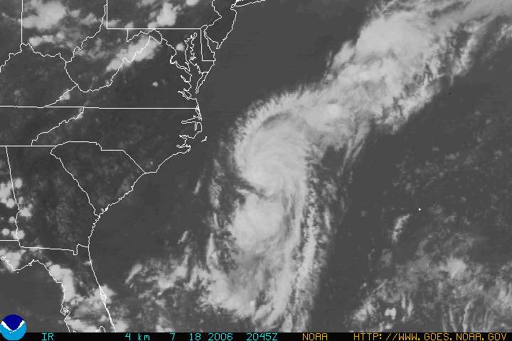
    Tropical Storm Beryl has formed off the Carolina coastline. Latest information on this storm is available at http://www.nhc.noaa.gov/index.shtml?text. My hurricane information frequency list was last updated July 6 and is posted to this blog.

    Monday, July 17, 2006

    Lebanon Ham Net Active

    Courtesy of the DX newsgroup and Hani OD5TE:

    In support of the current situation in Lebanon, the Arab Amateur Radio Emergency Service has been activated on 14.305 MHz in order to take Welfare and Emergency messages. At the same time all local repeaters in Lebanon will have priority for emergency use.

    OD5TE/R: 144.700- T88.5 (Covering Greater Beirut Are and Main Lebanese coastal road)
    OD5RAK/R: 144.025+ T88.5 (Covering Northern Lebanon)

    Repeaters will be linked through Echolink at all time to allow maximum coverage.

    Friday, July 14, 2006

    Satellite Launch 2006-026A


    The Bigelow Aerospace Genesis 1 was launched from a new Russian launch site on 12 July 2006 at 1453 UTC. The payload was launched on a Dnepr rocket (a converted SS-18 ICBM) from their new Dombarovskiy launch site, previously just an intercontinental missile base (also identified as the ISC Kosmotras space and missile complex in the Orenburg region of Russia).

    Bigelow Aerospace is located in North Las Vegas, Nevada. Genesis 1 is a prototype of hardware that the firm anticipates will advance habitable structures in space to carry out research and manufacturing, among other tasks.

    Intl Desig: 2006-026A, SSC #29252
    Orbital parameters:
    Apogee 561 km
    Perigee 555 km
    Inclination 64.5 deg
    The module inflated from 1.9 to 3.8 meters diameter once on orbit.

    We believe that the Genesis 1 might be carried a 2 GHz S-band downlink.

    Friday, July 07, 2006

    Night of Nights VII


    HISTORIC MORSE CODE RADIO STATION KPH RETURNS TO THE AIR FOR "NIGHT OF NIGHTS VII"

    From the Maritime Radio Historical Society website. Photo and information courtesy of MRHS.

    Former RCA Station KPH Celebrates Its 101st Anniversary
    Coast Station KSM Celebrates Its 1st Anniversary
    Coast Stations WLO, KLB, NMC and NOJ To Be On The Air
    New Frequencies for KSM, KLB and NOJ

    In the seventh annual event that has become known as the "Night of Nights", historic Morse code radio station KPH will return to the air in commemoration of the last commercial Morse message sent in the United States. Frequencies and reception report information for all stations appear below.

    KPH, the ex-RCA coast station located north of San Francisco, will return to the air for commemorative broadcasts on 12 July at 1701 PDT (13 July at 0001 UTC), 7 years and one minute after the last commercial Morse transmission in the US. These on-the-air events are intended to honor the men and women who followed the radiotelegraph trade on ships and at coast stations around the world and made it one of honor and skill. Transmissions are expected to continue until at least midnight PDT (0700 UTC).

    Veteran Morse operators, including former KPH staff members, will be on duty at the receiving station at Point Reyes, CA listening for calls from ships and sending messages just as they did for so many years before Morse operations were shut down.

    The transmitters are located 18 miles south of Point Reyes in Bolinas, CA at the transmitting station established in 1913 by the American Marconi Co. The original KPH transmitters, receivers and antennas will be used to activate frequencies in all the commercial maritime HF bands and on MF as well.

    Many of the KPH transmitters will be 50s vintage RCA sets. KSM will use a 1940s vintage Press Wireless PW-15 transmitter will be on its 12 MHz frequency. Power output will be 4 to 5kW. The transmitting antennas include a Marconi T for MF, double extended Zepps for 4, 6 and 8 MHz and H over 2s for 12, 16 and 22 MHz.

    KPH will send traffic lists, weather and press broadcasts as well as special commemorative messages, some of which will be sent by hand. At other times the KPH and KSM "wheel" will be sent to mark the transmitting frequencies.

    Members of the public are invited to visit the receiving station for this event. The station will be open to visitors beginning at 1500PDT (3:00pm). The station is located at 17400 Sir Francis Drake Boulevard and is on the route to the Point Reyes lighthouse. Watch for a cypress lined driveway on the right about a mile past the entry to Coast Guard station NMC.

    KPH is operated by the Maritime Radio Historical Society in cooperation with the Point Reyes National Seashore, part of the National Park Service.

    Further information may be found on the Maritime Radio Historical Society Web site or by contacting Richard Dillman at +1 415-990-7090 (email: rd@radiomarine.org or Tom Horsfall at +1 510-237-9535 (email: wa6ope@hotmail.com. Station Information follows...

    KPH
    KPH will transmit on 4247.0, 6477.5, 8642.0, 12808.5, 17016.8 and 22477.5 kHz on HF and 500 and 426 kHz on MF. These frequencies have been made available through the generous cooperation of Globe Wireless, the current owner of the KPH and KFS licenses. KPH operators will listen for calls from ships on ITU Channel 3 in all bands. The Channel 3 frequencies are 4184.0, 6276.0, 8368.0, 12552.0, 16736.0 and 22280.5 kHz on HF and 500 kHz on MF. Reception reports may be sent to: Ms. DA Stoops, P.O. Box 381, Bolinas CA 94924-0381 USA. Denice is a former KPH operator and was the first female telegrapher hired at the station.

    KSM
    Note the addition of a 16 MHz channel for KSM this year. KSM will transmit on 426, 500, 6474, 12993 and 16914 kHz. KSM will listen for calls from ships on 500 kHz and HF Channel 3 (see KPH listing for frequencies). Reception reports may be sent to: Ms. DA Stoops, P.O. Box 381, Bolinas CA 94924-0381 USA

    WLO
    This information has not been confirmed by WLO at the time of this announcement. WLO will transmit on 438, 500, 8514.0 and 12660.0 kHz. WLO will listen for calls from ships on 500 kHz and HF Channel 3 (see KPH listing for frequencies). Reception reports may be sent to: WLO/KLB, 700 RINLA AVENUE, MOBILE, ALABAMA 36619 USA or via email to: wloradio@wloradio.com.

    KLB
    Note the expanded frequencies for KLB! This year KLB has added MF, a 2 MHz frequency and a 12 MHz frequency. A tip of the MRHS earphones to CJ of KLB for all the work he has done to bring this about. KLB will transmit on 488, 500, 2063.0, 6411.0 and 12917.0 kHz. KLB will listen for calls from ships on 500 kHz and HF Channel 3 (see KPH listing for frequencies). Reception reports may be sent to: WLO/KLB, 700 RINLA AVENUE, MOBILE, ALABAMA 36619 USA or via email to: wloradio@wloradio.com

    NMC
    NMC will transmit on 448, 472, 500, 6383.0, 8574.0 and 17220.5 kHz. NMC will listen for calls from ships on 500 kHz and HF Channel 3 (see KPH listing for frequencies). Reception reports may be sent to: COMMANDING OFFICER, ATTN ITC ERIC SIMMONS, COMMUNICATIONS AREA MASTER STATION PACIFIC, 17000 SIR FRANCIS DRAKE BLVD, POINT REYES STATION, CALIFORNIA 94956-0560 USA

    NOJ
    Note that NOJ will be operational on MF this year! NOJ will transmit on 416, 470, 500, 8650.0, 12889.5 and 16909.7 kHz. NOJ will listen for calls from ships on Channel 3 (see KPH listing for frequencies). Reception reports may be sent to: COMMANDING OFFICER, ATTN OSCM WILLIAM KECKLER, US COAST GUARD COMMUNICATIONS STATION KODIAK, PO BOX 190017, KODIAK, ALASKA 99619 USA

    BT
    BV ES VY 73 TO ALL,
    MRHS

    Wednesday, July 05, 2006

    A Special Offer for MT Blog Readers


    The good folks at Monitoring Times magazine are offering a special, limited time, discounted rate of US$14.95 on a one year MT Express subscription if you mention the BLOG page (Editor’s Page, Fed Files, Milcom, Monitoring Post, or Shortwave) you are viewing right now.

    What is Monitoring Times magazine?
    MT is a full-spectrum monthly magazine for the radio listener, Monitoring Times covers scanning, shortwave, military and federal comms, and other radio topics from below 500 kHz to 900 MHz and above. Presented in an easy-to-understand style by an experienced writing staff, MT helps you get the most out of your time and your equipment with practical listening tips and frequencies.

    What is MT Express?
    MT Express is the same magazine as our printed version but it is presented in Adobe Acrobat portable document file (pdf) format, including full color photography and active links to URLs and email addresses. It is the fastest and easiest way to get the information and frequencies you need on the radio hobby.

    You can see what is in current issue of MT, including sample pages on the MT current issue webpage.

    This special offer is for first-time subscribers and renewals. This offer is available for a limited time only (must be used by the close of business July 31, 2006) and can only be used one time per customer.

    So if you like what we do here on the MT Blog pages and you want even more, then pick up that telephone and call the MT order desk toll free at 1-800-438-8155 (Mon-Fri 9a-5p EDT) and get US$5.00 off the regular price of MT Express.

    And remember you have to mention the BLOG page you are viewing right now in order to get the MT Express Bloggers discount.

    STS-121 (2006-028A) 06185.80348940 TLE


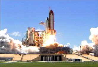
    The launch of the STS-121 mission occurred from the Kennedy Space Center at 1837:55 UTC. The NORAD SSC number is 29251 and the international designator is 2006-028A.

    Here is the latest two line element set for STS-121.

    STS-121
    1 29251U 06028A 06185.80348940 .00055600 12106-4 74006-5 0 17
    2 29251 51.6297 97.2629 0057780 342.0046 193.3540 16.29698905 02

    Tuesday, July 04, 2006

    NASA Space Shuttle Launch TLEs - Again


    Here are the posted elements for the launch attempt this afternoon July 4.


    SHUTTLE TRAJECTORY DATA

    Lift off time (UTC) : 2006/185/18:37:55.000
    Area (sq ft) : 2700.0
    Drag Coefficient (Cd) : 2.00
    Monthly MSFC 50% solar flux (F10.7-jansky) : 79.4
    Monthly MSFC 50% earth geomagnetic index (Kp) : 2.22
    ET - UTC (sec) : 65.18
    UT1 - UTC (sec) : 0.00

    Coasting Arc #1 (begining on orbit 1)
    Vector Time (GMT): 2006/185/18:48:24.000
    Vector Time (MET): 000/00:10:29.000
    Weight (LBS) : 255113.7

    TWO LINE MEAN ELEMENT SET
    SHUTTLE
    1 99999U 06185.83405673 .00014500 00000-0 95600-4 0 9007
    2 99999 51.6298 97.0761 0039171 347.5451 12.4801 16.76636654 26


    Coasting Arc #2 (begining on orbit 1)
    Vector Time (GMT): 2006/185/19:16:26.918
    Vector Time (MET): 000/00:38:31.918
    Weight (LBS) : 252602.1

    TWO LINE MEAN ELEMENT SET
    SHUTTLE
    1 99999U 06185.83481559 .00014500 00000-0 95600-4 0 9015
    2 99999 51.6298 97.0838 0054912 341.1886 18.7277 16.30517194 26


    Coasting Arc #3 (begining on orbit 11)
    Vector Time (GMT): 2006/186/10:43:39.699
    Vector Time (MET): 000/16:05:44.699
    Weight (LBS) : 251561.4

    TWO LINE MEAN ELEMENT SET
    SHUTTLE
    1 99999U 06186.44742686 .00014500 00000-0 95600-4 0 9025
    2 99999 51.6324 93.6688 0083791 348.1321 11.7892 16.23859786 124


    You can get the complete set at Shuttle Trajectory Data

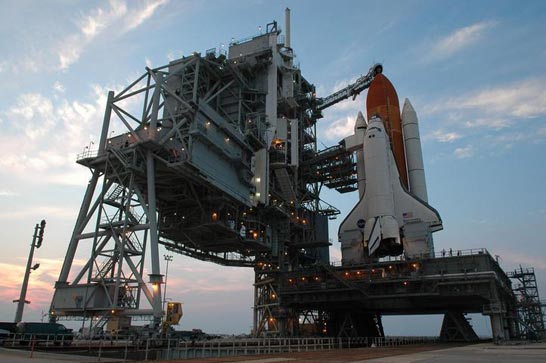
    Image courtesy of NASA/KSC.

    Space Shuttle Replacement Announced


    Even as NASA tries to get STS-121 off the launch pad at KSC, NASA has announced the new system that will replace the Shuttle Transportation System (STS), named Ares. The Crew Launch Vehicle, being developed on the basis of the Shuttle SRB to launch the next NASA human-carrying spaceship, will be called the Ares I. The planned heavy-lift follow on will be called the Ares V.

    It's appropriate that we named these vehicles Ares, which is a pseudonym for Mars," said Scott Horowitz, associate administrator for NASA's Exploration Systems Mission Directorate, Washington. "We honor the past with the number designations and salute the future with a name that resonates with NASA's exploration mission."

    The "I and V" designations pay homage to the Apollo program's Saturn I and Saturn V rockets, the first large U.S. space vehicles conceived and developed specifically for human spaceflight.

    The crew exploration vehicle, which will succeed the space shuttle as NASA's spacecraft for human space exploration, will be named later. This vehicle will be carried into space by Ares I, which uses a single five-segment solid rocket booster, a derivative of the space shuttle's solid rocket booster, for the first stage. A liquid oxygen/liquid hydrogen J-2X engine derived from the J-2 engine used on Apollo's second stage will power the crew exploration vehicle's second stage. The Ares I can lift more than 55,000 pounds to low Earth orbit.

    Ares V, a heavy lift launch vehicle, will use five RS-68 liquid oxygen/liquid hydrogen engines mounted below a larger version of the space shuttle's external tank, and two five-segment solid propellant rocket boosters for the first stage. The upper stage will use the same J-2X engine as the Ares I. The Ares V can lift more than 286,000 pounds to low Earth orbit and stands approximately 360 feet tall. This versatile system will be used to carry cargo and the components into orbit needed to go to the moon and later to Mars.

    Picture courtesy of NASA.

    Sunday, July 02, 2006

    STS-121 NASA Estimated Orbital Elments


    From Ted Molczan and the world famous Seesat-L newsgroup:

    Lift-off is scheduled for 2006 Jul 02 at 19:26:06 UTC. Spaceflight Now reports that the weather forecast is for only a 30 percent probability of GO for launch:
    http://www.spaceflightnow.com/shuttle/sts121/status.html NASA's estimated elements are available at the following URL. They take into account all planned manoeuvres, and are revised throughout the mission, as required.

    http://spaceflight1.nasa.gov/realdata/sightings/SSapplications/Post/JavaSSOP/orb
    it/SHUTTLE/SVPOST.html


    For quick reference, I have extracted the elsets from MECO through docking.

    1. Jul 02, 19:36:34 UTC (MECO) - Jul 02, 20:04:45 UTC

    1 99999U 06183.81706019 .01000000 00000-0 37638-6 0 02
    2 99999 51.6315 107.4812 0133623 347.8400 69.9204 16.48996984 09

    NOTE: NASA's MECO 2-line elset is erroneous; so I generated the above by
    converting NASA's True of Day Rotating (TDR) [aka Earth-Fixed Greenwich (EFG)] Cartesian state vector to SGP4, using Ken Ernandes' VEC2TLE program, and added realistic decay terms for the brief duration of existence of the orbit. Our web site has a link to Ken's program:

    http://www.satobs.org/orbsoft.html#Other

    2. Jul 02, 20:04:45 UTC - Jul 03, 11:25:57 UTC

    1 99999U 06183.86828433 .00014500 00000-0 95600-4 0 9012
    2 99999 51.6315 107.1944 0055919 341.8910 18.0289 16.30320029 25


    3. Jul 03, 11:25:57 UTC - Jul 03, 16:01:09 UTC

    1 99999U 06184.48096052 .00014500 00000-0 95600-4 0 9026
    2 99999 51.6338 103.7803 0075880 339.8798 19.9405 16.25901597 126


    4. Jul 03, 16:01:09 UTC - Jul 03, 21:02:19 UTC

    1 99999U 06184.72675604 .00014500 00000-0 95600-4 0 9030
    2 99999 51.6304 102.4155 0074319 340.6093 19.2273 16.26481625 165


    5. Jul 03, 21:02:19 UTC - Jul 04, 11:20:37 UTC

    1 99999U 06184.91191402 .00014500 00000-0 95600-4 0 9041
    2 99999 51.6279 101.3924 0067724 147.0385 213.5038 15.93209272 193


    6. Jul 04, 11:20:37 UTC - Jul 04, 12:51:50 UTC

    1 99999U 06185.47638584 .00014500 00000-0 95600-4 0 9051
    2 99999 51.6296 98.4155 0010064 87.8137 272.4181 15.78424640 289


    7. Jul 04, 12:51:50 UTC - Jul 04, 14:11:14 UTC

    1 99999U 06185.53969537 .00014500 00000-0 95600-4 0 9064
    2 99999 51.6310 98.0883 0010018 46.9068 313.2933 15.76762016 298


    8. Jul 04, 14:11:14 UTC - Jul 04, 14:25:06 UTC

    1 99999U 06185.60307278 .00014500 00000-0 95600-4 0 9071
    2 99999 51.6314 97.7612 0009245 38.9159 321.2669 15.76455737 306


    9. Jul 04, 14:25:06 UTC - Jul 04, 15:40:00 UTC

    1 99999U 06185.60307255 .00014500 00000-0 95600-4 0 9087
    2 99999 51.6317 97.7611 0010246 36.0397 324.1457 15.76223425 308


    10. Jul 04, 15:40:00 UTC (docked to ISS)

    1 99999U 06185.66721116 .00014500 00000-0 95600-4 0 9090
    2 99999 51.6300 97.4474 0010473 36.1450 324.0420 15.76118558 317

    Ted Molczan